
Everyone needs a break from their jobs once in a while. When two people have two different jobs it is difficult to co-ordinate things. When to people work two different jobs from their home it seems impossible to break away! Where to go for a short break? While some might wish to go to a city to do shopping, others choose a different type of vacation!
We got into the car, and headed out.
The goal was Lubec, Maine… as far Down East as one can go.
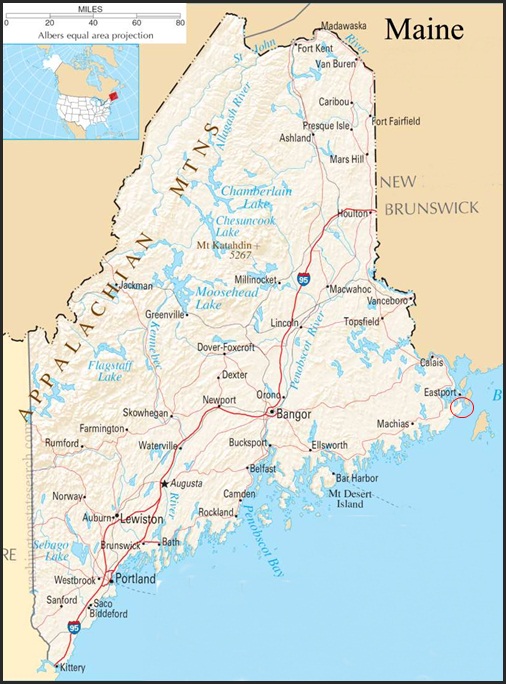
THE MAP of MAINE
Looking at the map of Maine above, one sees Kittery at the bottom left.
Following the coast line all the way up to the Canadian border one sees,
right below the town of Eastport, a small circle. That was the goal- Lubec.
There are two ways to get to Lubec. One is to meander along Route 1, past Ellsworth. It is worthwhile to drive down to Winter Harbor, Schoodic Point, Gouldsboro, Corea, Handley point, Joneport… each area has its own feel. And many of the towns one drives through have wonderful views and houses as well.
But, if you want to get to the top of the coast, bypassing summer traffic, the fastest way is to head to Bangor and take Rt. 9 across. On the map above it is the line that connects Bangor to Calais. There are several roads that drop down from it to Rt.1, making it easy to vary one’s trip, depending on what one wishes to see.
There are not many places to stop going across Rt. 9. If you are coming north, up Rt. 95, get off at the Hermon/Hampton exit, and go right on the Coldbrook Road, for about two blocks. On the left is a gas station/restaurant called Dysarts. It is clean, and they have good sandwiches, the home made white bread is great!
Continue to Bangor, and take Rt. 395 to connect with Rt. 9, and head east.
As you head over the Whalesback, there are townships on the right, and for the most part numbered grids on the left. If a person wants to live out away from the madding crowd it is certainly possible to do so!
In August, in mid-coast Maine, the fields are colored yellow with goldenrod and black eyed Susans, with pale astilbe, Queen Annes lace, and the early white asters softening the colors.
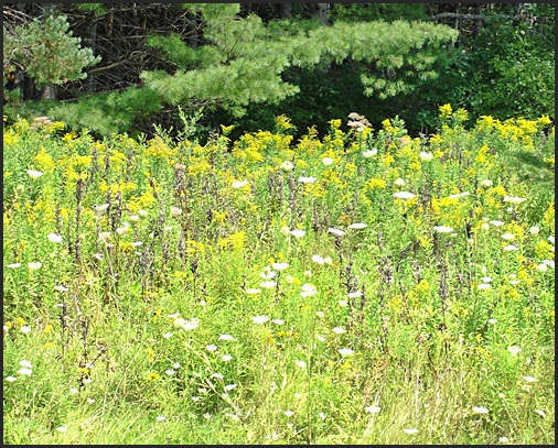
GOLDEN ROD, QUEEN ANNE’S LACE, and WHITE ASTERS
A little past the last road heading down to Ellsworth one starts to see patches of pink. These soon begin to be large swaths. By the time one hits the coast the predominate colors along the roadsides are pink. Fireweed and astilbe predominate with asters and an occasional plant goldenrod.
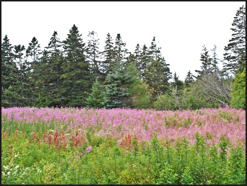
FIREWEED in DOWN EAST MAINE
ABOUT THE BLUES
One needs to decide where to head south to meet up with Rt. 1.
We chose Rt. 193, which leads down to Cherryfield.
Cherryfield is the blueberry capital of Maine. And August is when the blues come in.
Much of Washington county is given over to blueberries.
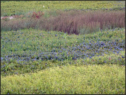
And coming south on 193 one crosses the Western Barrens.
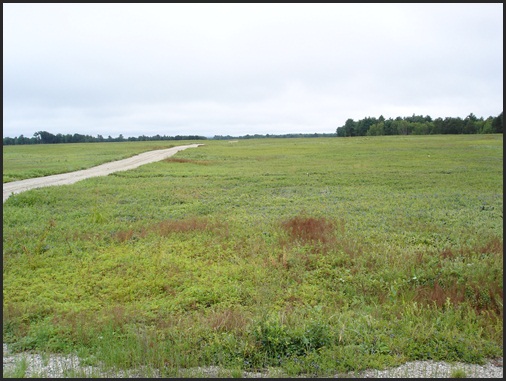
THE WESTERN BLUEBERRY BARRENS
The Maine blue berry is a native wild berry that grows on bushes about 12″- 15″ high.
They are smaller than the commercially grown berry one sees in markets.
It has a tough skin, and is packed with flavor and anti-oxidents.
They can be dried, frozen, or cooked. If you have eaten blueberry pie, jam, juice, or syrup you probably were eating Maine blueberries.
The annual Maine blueberry crop runs between 85-90 million pounds annually.
The majority of the crop is grown in Down East Maine on sandy barrens.
MAINE BLUEBERRIES
Leaving Cherryfield one turns north on Rt 1, heading for Harrington.
There is an Irving gas station on the left, a good place for a quick rest stop.
The next town is Columbia Falls. Take a quick trip through it, it has a certain charm all of its own.
For historic house buffs there is the Ruggles House, with its flying staircase, and elaborate woodwork.
Just past Columbia Falls on the right is the Wild Blueberry Land- known as the largest Maine blueberry!
… one can not miss it!
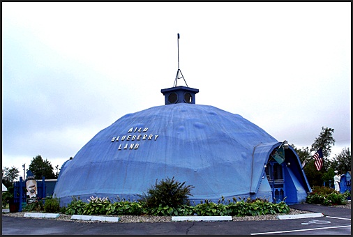
WILD BLUEBERRY LAND
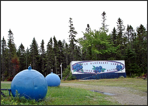
IT IS ALL ABOUT BLUEBERRIES!
Stop in for a blueberry ice cream cone!
And take home some blueberry oatmeal cookies, scones, or pie for dinner!
Anything you want that is blueberry related is there! Cups, pot holders, and more!
Moving on, our next goal was the Hannaford in Machias.
Yes, there is a store in Lubec, but the Hannaford is larger, and truthfully, nicer.
After stocking up on things needed for our stay we hit the Blue Bird Ranch Restaurant in Machia for lunch.
It is on the left, and serves basic, but good, food.
They also have a blueberry vinaigrette salad dressing worth trying, as well as salads with blueberries, and pie (of course).
Machias is only 30 minutes from Lubec. One goes through East Machias, which is very pretty with river, and streams, and turns off at Whiting, leaving Rt.1, which heads north to Calais.
And one takes Rt. 189 on the last leg of the trip.
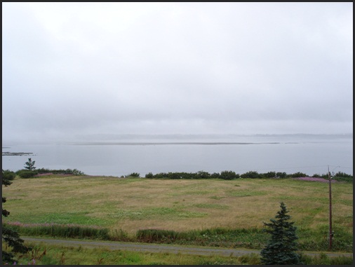
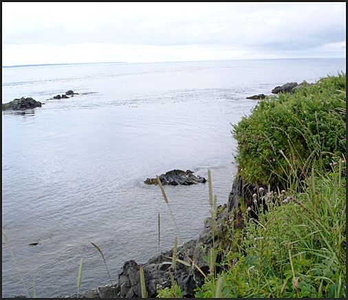
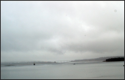
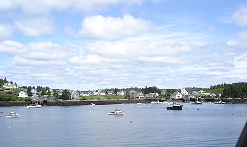
Lubec is at the end of a piece of land known as The Neck.
Coming this way, this is the first one sees of the ocean.
The the clouds are different, the air is different.
One is Down East, we had arrived.
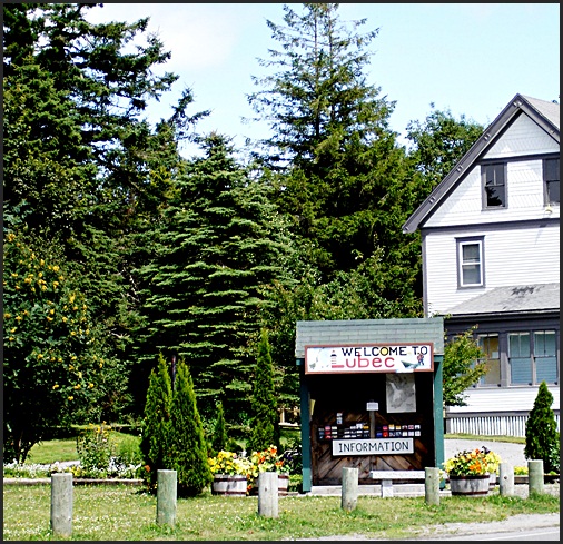
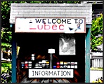
THE LUBEC, MAINE INFORMATION CENTER
LUBEC- DOWN EAST MAINE
Lubec, Maine is as far Down East as one can go in Maine. The term “down east” comes from whaling days.. When whaling ships of Nantucket rounded Cape Cod, they rode the wind “down east” to the whaling and fishing grounds. While those days are gone, people still sail down east, or drive down east. One can also live either Down East or up east… you might hear someone say oh, that’s up east- but, up east is not Down East!
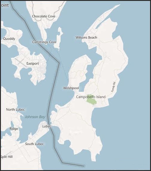
Passamaquoddy Bay is a body of water that lies between Maine and New Brunswick, Canada at the mouth of the St. Croix River. It is filled with islands, and has many peninsulas and points. The bay opens into the Grand Manan Channel, part of the Bay of Fundy. Two Canadian islands, lie closer to the US side of the bay than the Canadian, they are Campobello Island and Deer Island.
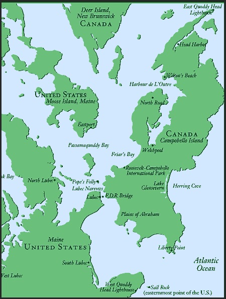
LUBEC and SURROUNDING AREA
There are three passages into the bay- one north of Deer Island- Letete Passage, one between Deer Island and Campobello Island- Head Harbour Passage; and a third lies between Campobello island and Lubec, Maine- Quoddy Narrows. Head Harbour Passage is the deep water passage into the bay, and it is Canadian. The international border follows the different channels.
On the American side of the bay, at its mouth, is a short oval peninsula that juts out toward the lowest tip of Campobellow Island. It marks the opening to the Quoddy Narrows. This is West Quoddy Head- the most eastern point of land in the USA. Lubec and a point of Campobello mark the upper end of the narrows. The FDR Memorial Bridge crosses the narrows at that point, connecting the two countries.
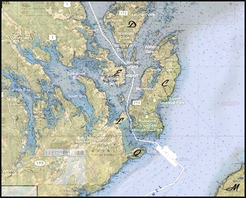
MAP SHOWING INTERNATIONAL BORDER
THROUGH PASSAMAQUODDY BAY
On the map above:
C= Campobello Island, D= Deer Island, M= Grand Manan Island, L= Lubec, and E= Eastport.
We were not staying in Lubec, but out toward West Quoddy Head.
So after a quick drive through town to see if anything was changed, we headed out to town,
and took South Lubec Road,
out past the sand bar, and took a left toward the Light.
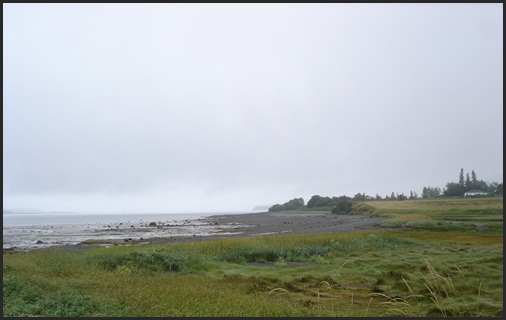
THE BEACH ALONG THE SOUTH LUBEC ROAD
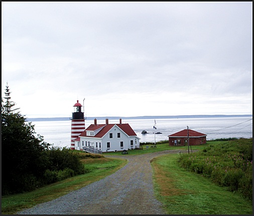
We had decided to stay at the old Quoddy Head Coast Guard Station
First built in 1917 it had been decommissioned in 1970,
and all operations were run out of Eastport.
A man from Connecticut bought it, renovated it, and now rents out kitchen units, and a cottage.
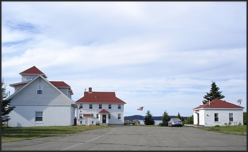
THE OLD WEST QUODDY HEAD COAST GUARD STATION
We went into the cabin, a large single room,
furnished with a mixture of vintage furniture, pictures, lamps, and tables,
giving the effect of Maine Cabin decor.
A queen size bed, a pull out sofa, wifi, and telephone service are modern amenities!
We unpacked our groceries, put away are clothes, and made a pitcher of iced coffee.
Books and coffee in hand we went out on the porch to read.
Peace, quiet, clouds, grey sky, slight wind, no rain… wonderful…
The occasional call of a gull, the sound of a bell at sea. Perfect.
Twilight came softly and we enjoyed the view from the porch before going in to cook dinner.
TWILIGHT on WEST QUODDY HEAD
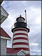
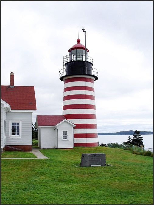
WEST QUODDY HEAD LIGHTHOUSE
The next morning we were up early to get out and about. Many people think that because West Quoddy Head is the most eastern point in the USA that one would be the first in the US to see the sun rise. This is not always true.
It is seen first at West Quoddy Head around the equinox. In the spring and early summer sunrise is seen first at Mars Hill, north of Houlton, Maine. But, from October 7 through March 6 the sunrise is first seen, when in the USA, from the top of Cadillac Mountain, in Acadia National Park, on Mt. Desert Island, near Bar Harbor. It is 1,532 feet tall, and the sunrise is seen there first, in the winter, when the sun rises south of due east.
For the New Year of the Millennium there was a great deal of rivalry over this. On January 1, 2000 it was said that some person, standing in a tower, in Lubec, saw the first sunrise. But the US Naval Observatory finally stated it was definitely first seen on top of Mt. Cadillac. But, the first sunrise to be seen at sea level on January 1 is at both Lubec and Siasconset, on Nantucket Island, Massachusetts.
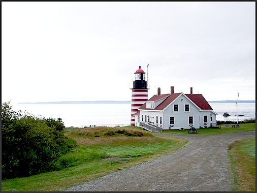
The West Quoddy Head Lighthouse is about a mile from the old Coast Guard station. An easy walk, run, or drive! Lighthouse is adjacent to the West Quoddy Head State Park which has hiking trails, pic-nic tables, and an arctic bog. It is also an excellent birding area.
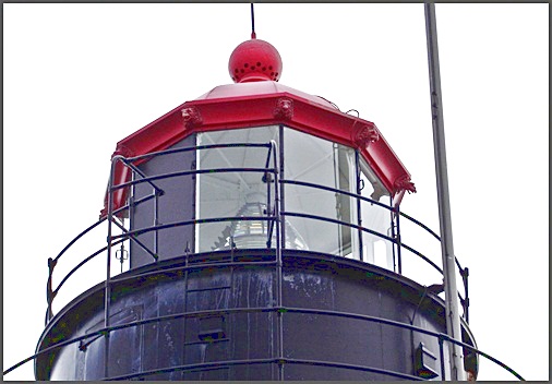
WEST QUODDY HEAD LIGHT
In 1806 citizens of Eastport petitioned the government for a lighthouse at the opening of the Passamaquoddy Bay, as the area is filled with basalt rocks, and for much of the year there is heavy fog, making it a very difficult place to navigate. And they suggested that it be on West Quoddy Head, at the present spot as it was forty feet above the waterline. They also suggested that the tower be no less than 75′ tall, not including the light itself. Congress appropriated money for the light station and a small wooden house, on April 21, 1806. These were finished in 1808.
The orignial West Quoddy Head light house was a wooden tower. Because of the amount of fog in the area it was not very effective, and a fog cannon was also used. One of the first fog bells was added in 1812. When a ship approached in the fog, they fired a signal cannon. When the lighthouse keeper heard it he would start tolling the bell. This arrangement continued, until a mechanical ringer was installed. Four different fog bells were tried, but none were effective, as they were difficult to hear off shore.
The original lighthouse needed to be rebuilt in 1830. And a new rubblestone tower, 49″ high, was finished in 1831. The present brick tower was built in 1857, along with a new light house keepers house. A third order Fresnel lens was installed.
The famous red and white stripes were added soon after it was built. Only one other light house has red and white horizontal stripes- the Assateague Light in Virginia. The Quoddy Head Light has 15 stripes, the Assateague Light has seven thick stripes.
A Dabool trumpet fog whistle, powered by hot air, was installed in place of bells, in 1866. But, it was not powerful enough, and in 1868 a steam whistle was installed.
The light was originally fueled with whale oil. In the 1860’s lard oil was used, which was changed to kerosene around 1880. It was electrified in 1934, and a flasher changed the beacon to a flashing light every 15 seconds. The light house was automated in 1988. The light is visible for 15-18 miles. The flash sequence is 2 seconds on, 2 seconds off, 2 seconds on, 9 seconds off- most unusual, but very distinctive.
The West Quoddy Head light house became part of the Quoddy Head State Park in 1998, and is property of the state of Maine. The light is maintained by the Coast Guard. In 2004 the lantern was restored, and the lighthouse is now close to its original appearance.
WEST QUODDY HEAD LIGHTHOUSE LENSE
The West Quoddy Head Lighthouse has a Fresnel lens.
It is one of eight Fresnel lenses in use in Maine, and is the only third order lens.
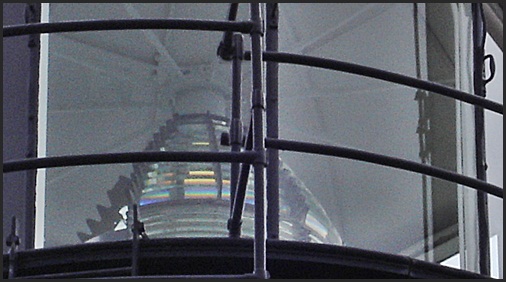
WEST QUODDY HEAD LIGHTHOUSE
The Original Fresnel Third Order Lense
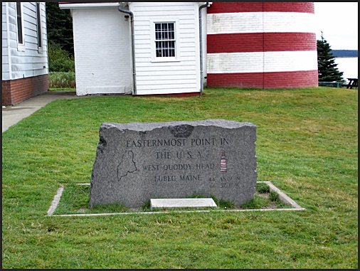
MARKER AT WEST QUODDY HEAD
WEST QUADDY HEAD
Cliff with Rugosa Roses blooming
Grand Manan on the left horizan
Blooming on the cliff with full exposure to the salt
were Rugosa roses, daylilies, thistle, and Rheums.
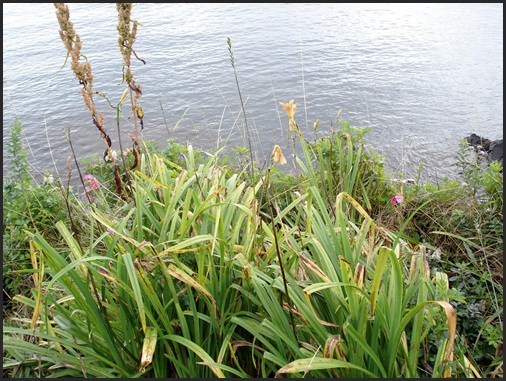
FLOWERS ON CLIFF EDGE
At West Quoddy Head
While we were there a lobster man was pulling traps,
and a Coast Guard buoy tender showed up to check on a buoy.
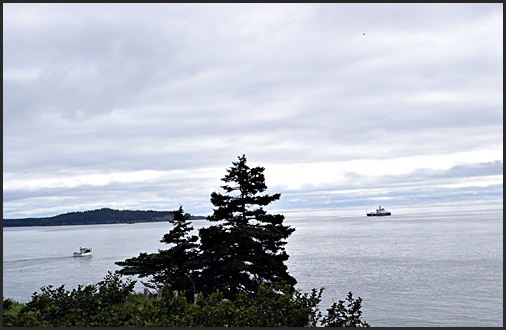
LOBSTER BOAT and COAST GUARD BUOY TENDER
Off of West Quaddy Head
AN INTERESTING BIT of HISTORY
The West Quoddy Head Lighthouse was built in 1808. In 1812, the year the War of 1812 began, the British captured the town of Eastport, Maine and gained control of the lighthouse. The lighthouse keeper at the time was an American, Peter Godfrey. The British promised to pay him for continuing to man the light, but never did. The local customs inspector wrote to the U.S. Lighthouse authorities asking them to pay him, as he had not been paid for several months, was poor, and had a large family to support. Godfrey continued to man the light. The light was returned to American control in 1814 when the Treaty of Ghent was signed, signaling the end of the war.
It was time to move on and we headed back toward Lubec,
Campolbello Island was our next destination.
RESOURCES
http://www.lighthousefriends.com/index.html
http://lighthouse.cc/westquoddy/history.html
http://www.uscg.mil/history/weblighthouses/LHMe.asp
http://lighthouse.cc/
http://www.usno.navy.mil/USNO/astronomical-applications/astronomical-information-center/first-sunrise
Wikipedia
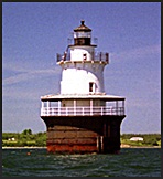
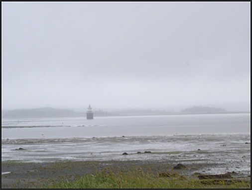
THE LUBEC, MAINE CHANNEL MARKER- The Spark Plug
As one drives back from West Quoddy Head along the Narrows, one sees a small round channel marker. This is the Lubec Channel Light, on the western side of the channel, in USA waters.
THE LUBEC NARROWS CHANNEL LIGHTHOUSE
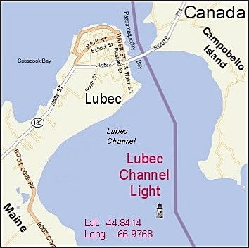
MAP OF THE LUBEC NARROWS
Showing the Location of the Lubec Channel Light
The Lubec Narrows were dredged in the early 1800’s to make it more accessible for the shipping industry. There were, at it’s height, 20 sardine packing plants in Lubec. It was felt that a light in the narrows would give night time access to the bay, furthering commerce. As there isn’t an island or rock on which to build a conventional lighthouse, the Lubec Channel light is a caisson light, known as a spark plug or teakettle light. Funding was obtained from Congress in 1886. And borings were made into the channel bed. More money for the project was appropriated in 1888.
Caisson construction uses a pneumatic process to sink a cylinder into the bottom of the ocean floor, pumping out water and sand to sink the cylinder deeper and deeper. This construction is used in places that need to withstand pressures of tides and ice. Foundations of lighthouses and bridges are good examples of where it is used. The Lubec light is a 40 foot cast iron tower mounted on top of a cylinder of rolled iron plates, that are lined with brick. It was assembled on land and then floated to its current position, where it was sunk into the sea bed.
The iron caisson is 33′ across, 48′ high. It was cast in eight sections of thirty two plates each. It was to be sunk 11 feet below extreme low and 36 feet below extreme high water and filled with concrete.
In August of 1889 the caisson was pumped out, and sunk 4′. But, on August 29 water erupted through the subsoil. A sub-foundation of pilings was needed.
The following April 185 spruce logs were arranged inside the caisson, and driven down with in it. It was then sunk 6′ and filled with concrete.
More money was needed to complete the lighthouse. In 1890 the superstructure of the lighthouse was finished. It is is 37′ high- from base to focal plain. Originally it was painted brown. But, in 1903 was painted white. It has five levels- two are the living quarters, and there are cisterns in the basement. A fifth-order Fresnel lens and a 1200 pound fog bell, struck by machinery, were installed.
The station went live on December 31, 1890. The light flashed at 15 second intervals, 61 feet above water.
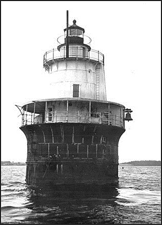
THE LUBEC, MAINE CHANNEL LIGHTHOUSE
Courtesy of the Coast Guard
The lighthouse was manned until 1939, when the assistant lighthouse keeper died from the gas fumes of a coal stove. It was automated shortly afterwards by the installation of an acetylene gas system and a sun valve.
In 1985 the original Fresnel lens was removed, replaced by a solar powered optic light, which flashes every 6 seconds. It has fog signal that sounds ever 15 seconds.
In 1989 the Coast Guard decided to discontinue its use. It had, over time, developed a strong lean, and was in disrepair. The town of Lubec mounted a campaign to save it. And in 1992 a $700,000.00 renovation began. This included driving new pilings into the bedrock to stabilize it, and to correct the tilt. One piling was drive 149′. Over 200 cubic yards of concrete were pumped into the caisson which was reinforced with new plates. Though not quite straight, the lighthouse is almost aligned. It has a lean of about 6 degrees, but is considered stable. The lighthouse continued to be maintained until 2001, when it was given a coat of new paint.
Then in 2006 the Coast Guard decided to sell the lighthouse. Under the National Historic Lighthouse Preservation Act of 2000 they made it available for new ownership. It was offered, at no cost, to eligible entities, including federal, state, and local agencies, non-profit corporations, and educational organizations. When no one wanted it, it put up for auction. It was auctioned in July, 2007 to Gary Zaremba of New York, for the high bid of $46,000.
Though privately owned the light is still operational. It is one of three spark plug lights in Maine.
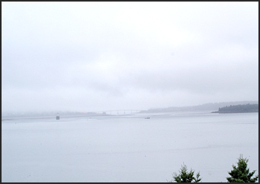
THE LUBEC NARROWS
With the Channel Light and the FDR Memorial Bridge
RESOURCES
http://www.uscg.mil/history/weblighthouses/LHMe.asp\
http://www.gramlighthouse.com/index.html
http://lighthouse-news.com/
http://www.lighthouse.cc/lubecchannel/history.html
http://www.nps.gov/maritime/constype/caisson.htm
CAMPOBELLO ISLAND,
NEW BRUNSWICK,
CANADA
Continuing our trip to Campobello Island we Headed back towards Lubec. One hits Rt. 189, and goes right, along The Neck. But, instead of heading left along Water Street, one swoops to the right, and heads up over the FDR International Bridge, to New Brunswick, Canada.
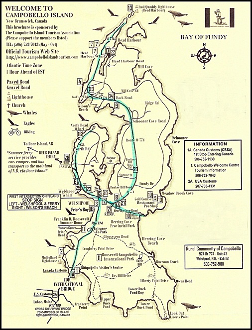
MAP of CAMPOBELLO ISLAND,
NEW BRUNSWICK, CANADA
A FEW THINGS TO REMEMBER
You need a passport to enter Canada.
While you can use American dollars on the island you might want to check the currency rates.
If you use a cell phone on the island make certain you are using an American band width,
or you will be charged a roaming fee.
You are entering a new time zone. The Maritime Provinces are on Atlantic Time:
They are an hour ahead of Eastern… 12 noon in Maine is 1 pm in New Brunswick.
Campobello Island is 8.7 miles long and about 3.1 miles wide. Several things about Campobello are very special. Points of interest are the Roosevelt Campobello International Park, East Quoddy Head Light, known as the Head Harbour Light, Herring Cove Provincial Park, a golf course that is said to be very good, amazing birding, and whale watching.
ROOSEVELT CAMPOBELLO INTERNATIONAL PARK
The parents of Franklin Delano Roosevelt, James and Sara Roosevelt, summered on Campobello Island. And owned a house there from 1883 onward. FDR was born in 1882, and spent much time there. He married Eleanor Roosevelt, a cousin, in 1905. And she also grew to love Campobello Island. Their neighbor, Mrs. Harman Kuhn, of Boston, became fond Eleanor, and offered the Kuhn cottage to Sara Roosevelt upon her death, meaning for it to go to Eleanor. Mrs Roosevelt purchased it, with 5 acres of land, in 1909, and left it to FDR. The cottage stayed in the family until 1952 when it was sold to Victor and Armand Hammer of Boston. They tried to sell it, and when they could not, donated it to both the American and Canadian governments, in 1963.
The park was created by an international treaty signed by the Governor General, the prime Minister, and President Johnson on January 22, 1964. It was established on July 7, 1964. The park is unique as it is on Canadian soil, but is funded, and administered and run by a joint Canadian and American commission. It is affiliated with both Parks Canada and with the US National Park Service.
The original gift comprised the house, its furnishings, outbuildings, and 10-12 acres of land. Though the significance of the time of the cottage is from the 1880’s through the 1930’s, the house is orientated to the 1920’s. Along with the FDR summer cottage, four other summer houses are part of 2800 acre complex that has grown from the original gift. There are carriage roads for biking, and paths for hiking. There are nature paths and gardens to explore, and this year a unique program call Tea with Eleanor was instituted. In the cottage, at 3 in the afternoon one can enjoy a true, proper tea, and talk about Eleanor, one of the most influential First Ladies there has been.
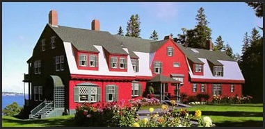
THE FDR SUMMER COTTAGE
Campobello Island
THE HERRING COVE PROVINCIAL PARK
Along with the Roosevelt Campabello International Park is an often over looked area: the Herring Cove Provincial Park. It lies just north of the International Park at the island’s waist. This 1050 acre park has a golf course, camping facility, and trails that intertwine with the International Park. That is over 3800 acres to enjoy!
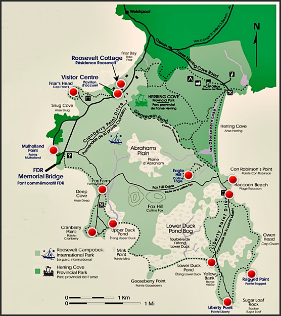
HERRING COVE PROVINCIAL PARK
ROOSEVELT CAMPOBELLO INTERNATIONAL PARK
We continued up the island, on the western side, past Friar’s Bay. There are views to Eastport, Maine. One drives past the Ferry landing for Deer Isle, New Brunswick, and ends up at a turn around. Then we headed back down and took Rt. 774 toward the top of the island where the East Quoddy Head Light, known as the Harbor Light, is.
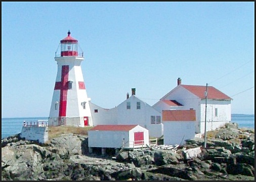
EAST QUODDY HEAD LIGHTHOUSE
known as the
HARBOR HEAD LIGHT
Campobello Island, N.B., Canada
The East Quoddy Head Lighthouse was built in 1829 at the northern tip of Campobello Island. It stands on a small islet at the opening of the to the Passamaquoddy Bay into the Bay of Fundy, looking right at the southern coast of New Brunswick, with Deer Island to the west. This is the deep water entrance into Passamaquoddy Bay. It was the second lighthouse built in New Brunswick- the first being at St. John Harbour.
The lighthouse standing today is the original wooden tower, 51″ tall. Originally eight lamps with 22″ reflectors were used, with 1/2″ flat wicks. In 1840 a lighthouse keepers house was added. And two years latter a larger lantern room replaced the original, which was moved to the St. Andrews lighthouse. The new lantern room was 9′ across, and had glass panes of 20 x 15″. It was in 1842 that the large red cross of St. George was painted on the eastern side of the tower, as a distinctive mark. Many Canadian lighthouses have red markings to show up against winter snow. In 1875 the lamps were changed to seven flat wick lamps, with 18″ reflectors, with 1″ flat wicks, which gave a much better light at sea. In 1875 Gannet Rock Lighthouse received a new signal gun, and its old one went to Head Harbour.
In 1877 a new steam powered Neptune fog trumpet was installed on the east side of the dwelling. But, it was discontinued in 1878 as it did not work well. A new model was put into use in 1880. This sounded 8 second blasts, separated by 35 seconds. And was hailed as “the loudest and best sounding fog alarm in the Bay of Fundy.” It was at this point that the lighthouse operation required two men to operate it. And a new house was built for the fog alarm engineer. In 1905 the fog bell, eight feet north of the lighthouse was equipped with machinery that would deliver two quick strokes to the bell, every thirty seconds. And in 1915 a new fog alarm building was constructed, and a new a class-C diaphone fog signal was installed.
In 1887 a new lantern room was installed, with plate glass windows to house a third-order Fresnel lens.
A fog alarm building and a work shed were added in 1914-1915, and a boathouse in 1947.
The light today is still activated, but not manned. It was automated in 1986. It has a continuous red light. And a fog horn that blasts 4 seconds every 60 seconds. This is the oldest surviving lighthouse in New Brunswick, and one of the few with most of the original structures intact. In 1988 the original 1829 tower received classified status from the Federal Heritage Building Review Office. The Friends of Head Harbour Lightstation was a group formed in 2000. Their aim is to preserve the buildings, protect, and promote the unique heritage of the lighthouse for the enjoyment and education of all.
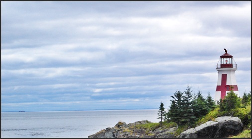
EAST QUODDY HEAD LIGHTHOUSE
As the Head Harbour Lighthouse is on a small rocky knoll, cut off from the main land, it is hard to get to. It is accessed at low tide. There is between 1 1/2 – 2 hours before low tide and about 1 hour after low tide when one can get out there. The window one can get out to the light is short. The tides at this point churn in and out from the Bay of Fundy, and rise about 5 feet an hour. The water is very cold, and hypothermia sets in within 3 minutes of being immersed in it. To get out to the light one goes down an iron ladder, crosses over rocks with seaweed, and up another iron ladder, across a small rock island, down more ladders, and up another set to reach the light.
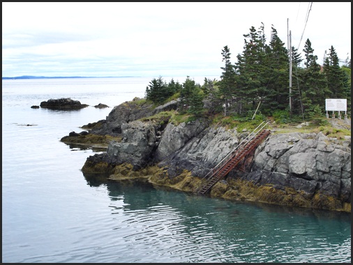
LADDERS TO THE EAST QUODDY HEAD LIGHT ISLAND
If you go out to the light,
make certain to check your watch and a tide chart, remembering the time difference.
A tide chart will be showing Atlantic time, as you are in New Brunswick.
HARBOUR HEAD LIGHTHOUSE
Campobello Island
For those who don’t think they are up to this,
one can look out across the water from just below the parking lot.
We saw whales moving along. Seals, and sea otters are also common.
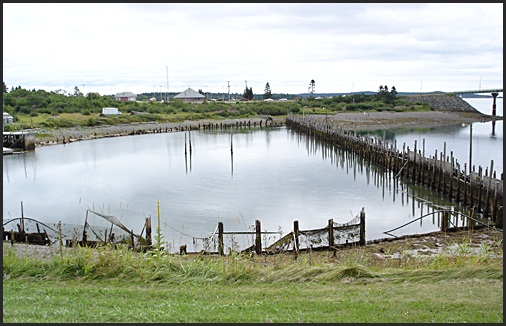
Just inside of the headland is an abandoned weir.
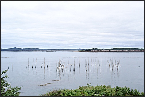
STAVES FROM AN OLD WEIR
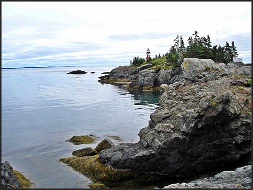
EAST QUODDY HEAD LIGHTHOUSE
Taking a last look at to see we left Harbor Head, and started down the road, heading for lunch.
We always eat at the bakery- it is on the right, heading south, just before the Herring Cove Road.
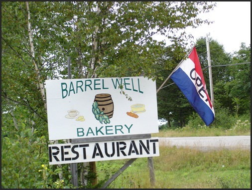
BARREL WELL BAKERY
Campobello Island
The bakery is small, unpretentious, but has good food.
Get there early- by 12 it is usually full!
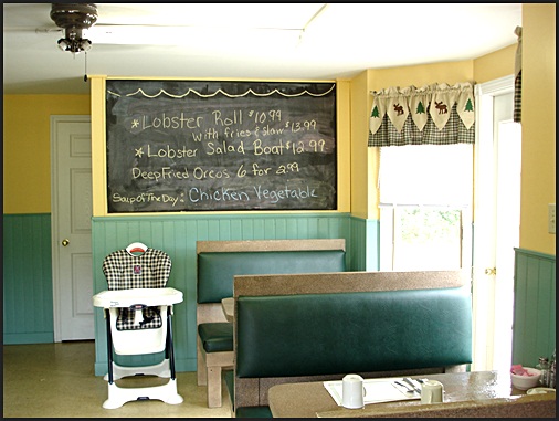
We had sandwiches for lunch- they were great.
But ONE of us got really curious about the fried oreo special on the board.
I asked if they would do just one, to sample.
And they very kindly did!
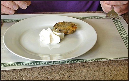
DEEP FRIED OREO COOKIE
One needs to be truthful…
In my opinion oreos are better enjoyed as is,
with a glass of milk!
Heading south on the last part of our trip we took a small side trip to an over-look, just south of Friar’s Bay. The economy of Campobello Island and Lubec are rooted in the sea. While there is some agriculture, and tourism is growing, it is the ocean that supplies the lively hood of the people, for the most part. And as one drives along the roads one sees boats, lobster traps, and other signs of fishing. At the over-look out to see one sees many of the islands looking up the narrows to Eastport.
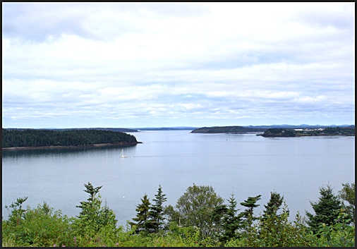
VIEW OF ISLANDS
From south of Friar’s Head
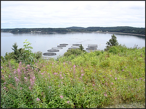
And on one side, looking north, are modern weirs.
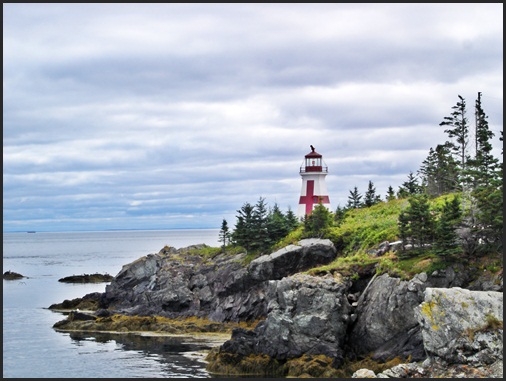
On the last part of our visit to Campobello Island we wanted to stop at the Mulholland Light, on Mulholland Point. The light is no longer operational, but is a commmanding presence on the Lubec Narrows.
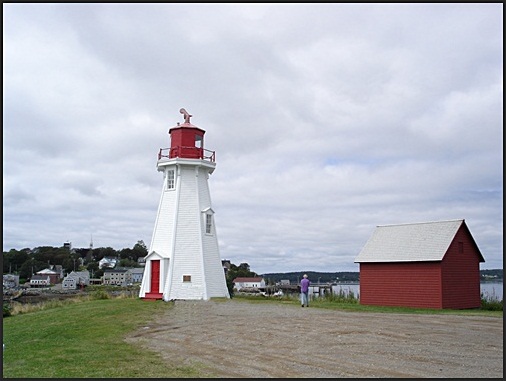
MULHOLLAND LIGHTHOUSE CAMPOBELLO ISLAND
Lubec, Maine in the background
In 1882 the Canadian Parliament was asked to have a lighthouse built on the southern end of Campobello Island. The idea was accepted, and an octagonal wooden tower, forty-four feet tall, including the vane on the top of the lantern, was completed in 1884. It has a base diameter of 22″. A fixed light lantern was installed in 1885. This stood 60″ above the high water line. The light held a 7th order, dioptric, oil-fueled lamp, which was visible for 13 miles.
In 1962, when navigational lights were installed on the new FDR Memorial bridge, the lighthouse was decommissioned. The lighthouse and shed were bought by a Campobello resident, Clifford Calder in 1963. He sold it to the Look family that owned the adjacent lobster pound. In 1984 the Look family donated the lighthouse, shed, and land to the Roosevelt-Campobello park in 1984 in Mr. Calder’s name.
OLD MULHOLLAND POINT LOBSTER POUND
Until the FDR Memorial Bridge was built the only way to reach Campobello Island was by boat or ferry. In 1962 the Canadian Parliament and the US Senate approved the building of the joint bridge, and the Franklin D. Roosevelt International Memorial Bridge was opened that year. In 1963 President Kennedy suggested the FDR summer home be preserved as a memorial to FDR, and as a symbal of international peace and good will between Canada and the United States. The opening of the International park followed in 1964. Both the park and the bridge are a symbols of our countries’ close relationship.
THE FDR MEMORIAL BRIDGE
spanning the Lubec Narrows between Lube and Campobello Island
viewed from the east
RESOURCES
http://en.wikipedia.org/wiki/Campobello_Island,_New_Brunswick
http://en.wikipedia.org/wiki/Campobello_Island
http://en.wikipedia.org/wiki/File:Roosevelt_cottage_at_Campobello.jpg
http://www.campobello.com/history.html
http://www.nps.gov/nr/travel/presidents/roosevelts_campobello.html
http://www.international.gc.ca/about-a_propos/oig-big/2001/roosevelt.aspx?lang=eng&view=d
http://fdr.net/home
http://www.suite101.com/content/tea-with-eleanor-at-roosevelt-campobello-international-park-a381082
http://www.lighthousefriends.com/light.asp?ID=1020
Scans of maps courtesy of the Campobello, New Brunswick Tourist Association
Photograph of FDR cottoage courtesy of the National Park Service
Photograph of Harbor Head Light from the water courtesy of Creative Commons by Joyce Morrell
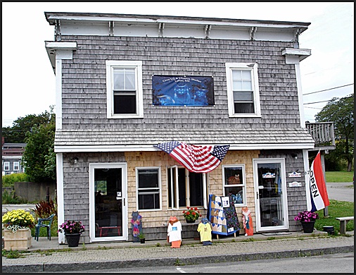
LUBEC, MAINE WELCOME CENTER
As one drives from Campobello Island back to Maine Lubec is to the right. The town sits on a hill, criss-crossed by streets running up and over it, another wraps it at the base.
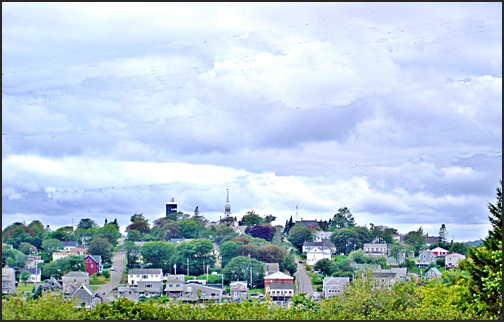
LUBEC, Maine
from Campobello Island
Lubec, Maine was founded in 1785, and was part of the town of Eastport, Maine, which was part of the state of Massachusetts until 1820. It was named after Lubec, Germany. On June 21, 1811 it was incorporated. The governor of Massachusetts signed into law the Legislative Act which separated Lubec from Eastport, making it the most eastern town in the United States, as it remains to this day.
So this year is Lubec’s 200th year anniversary!
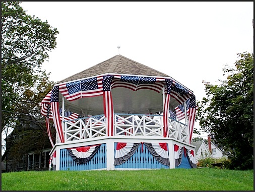
THE LUBEC, MAINE TOWN GAZEBO
The town of Lubec has over 90 miles of coast line. The average mean tide is 18′, and some are over 20′. The sea has played a huge role in the history of the area, and continues to do so. Fishing has always been a major way of life. At one point there were over twenty sardine canneries and smoke houses lining the wharf. The last one closed in 2001, after 100 years of running. Boat building, smuggling, and pirating were also major ways of getting an income.
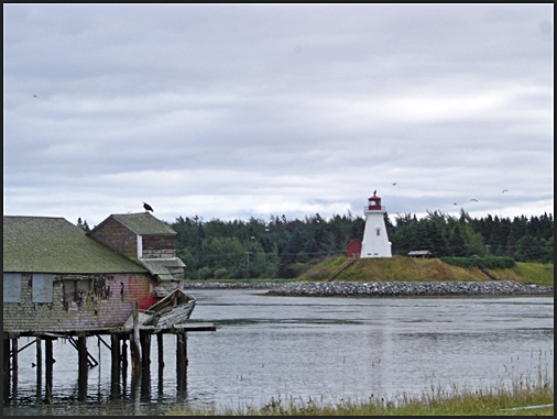
OLD WAREHOUSE on WATER STREET
A bald eagle on the roof;
in the background
Mulholland Light, Campobello Island, New Brunswick, Canada
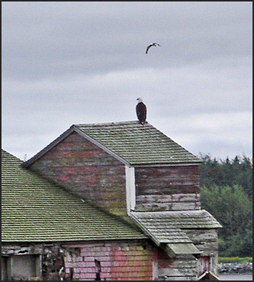
BALD EAGLE
a not uncommon sight.
Today the ocean still provides the major lively hood of the area- fishing, lobstering yes; but there are also whale watching and boat tours as well. And while the buildings lining the wharf no longer are home to the sardine industry, there are shops, galleries, and restaurants instead.
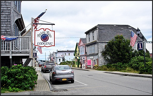
WATER STREET, LUBEC, MAINE
The main shopping street
Like all small tourist towns the galleries and boutiques are fun to prowl through.
But, two things in particular stand out on this street.
The first is the
SOS Give Us a Chance Cat Shelter
THE SOS GIVE US A CHANCE CAT SHELTER
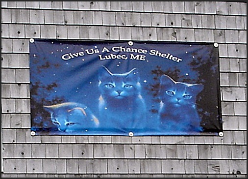
SOS GIVE US A CHANCE SHELTER-
the sign says it all.
This is a registered, non-profit organization whose goal is to help the feral cats in the area. They provide, food, shelter, and vet care. They are trying to expand the space they have for housing cats and kittens. And while they need money, donations of towels, blankets, and other things are welcome.
Please read about them on their website:
The Give Us a Chance Shelter,
the most easterly cat shelter in the USA:
http://www.soslubecme.org/
And, if going to Lubec consider taking towels or sheets no longer needed and dropping them off there.
Any help would be most appreciated! A full list of needs is on the website.
There are also YouTube films of cats in need of adoption: see YouTube SOS Adopt a cat Lubec
The other thing that was interesting was found at the ice cream shop!
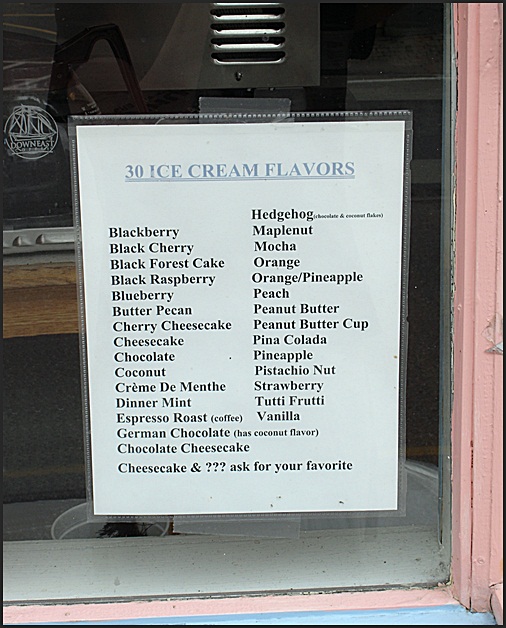
HEDGEHOG ICE CREAM CONE
Chocolate ice cream with coconut flakes!
After a last look around we headed back to the West Quoddy Coast Guard Station for a quiet afternoon of reading. The end of a wonderful day, filled with air, sea, and memories.
RESOURCES
http://lubec.mainememory.net/page/2273/print.html
SOS Give Us a Chance Cat Shelter, Lubec, Maine: http://www.soslubecme.org/
The next day it was time to leave. Taking a last look at Lubec, we headed down the Neck, taking a left on Rt 191 to Cutler. Cutler is a very pretty town, set on a narrow harbor, that bends around to Little Machias, south of East Machias, Maine.
CUTLER, MAINE
It is from Cutler that one can take one of the boats to Machias Seal Island, fifteen miles off of the main land. Machias Seal Island is home to a puffin breeding colony. Though there are boats from other places, this is the shortest of the boat trips. This colony is one of the few where people are allowed to visit, to actually get out onto the island. There are many different bird species there, a birders delight. See below for information on getting there.
The other interesting thing about Cutler is it is the home of the Cutler Naval Station. As one approaches Cutler one sees immensely tall towers looming in the distance, driving down from Machias they are very dramatic. If you drive to Little Machias you can get an amazing view of them.
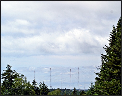
CUTLER NAVAL STATION TOWERS
The Cutler Naval station was completed in 1961. With 2,000,000 watts it is the most powerful LVF (low voltage frequency) station in the world. Or to put it another way, it is a unique radio transmitting station with the capacity to send one way communications to the Atlantic and Arctic submarine fleets.
The antenna is formed of two six sided stars each with a main tower 980 feet tall. Each of these have six intermediate towers 875 feet tall, and six outer towers of 800 feet. Each star is 6,200 feet across.
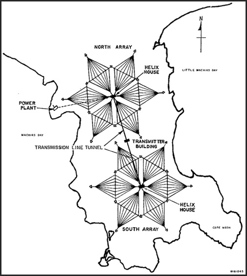
CUTLER NAVAL STATION
TOWER ARRAY
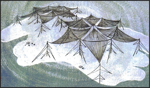
THE CUTLER NAVAL STATION TOWER ARRAY
showing the shields formed between the towers.
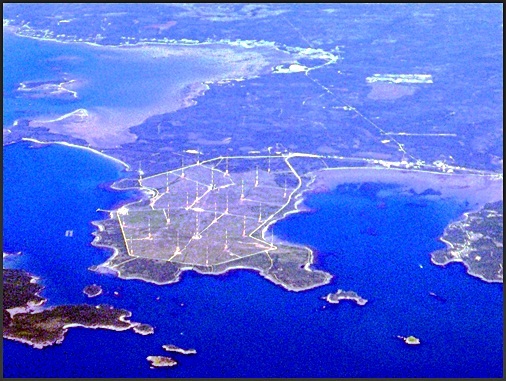
AN AERIAL VIEW OF CUTLER NAVAL STATION
Looking for a view of Cutler Naval Station I happened upon the photograph above.
It was taken by a man on Flickr, Kobus 2C.
I wrote asking if I could use it, and he very kindly said yes.
I did edit it to show the layout and towers better, once it had been resized.
For more of his work, see below.
RESOURCES
Machias Seal Island: http://www.neseabirds.com/machias.htm
Cutler Naval Station: http://navy-radio.com/commsta/cutler.htm
First diagram of the Cutler Naval Station from Wiki commons
Second diagram of the Cutler Naval Station from http://navy-radio.com/commsta/cutler.htm Aerial photograph of Cutler Naval Station by Kobus 2c on Flickr:
